LOST CITIES, a new four-part series on National Geographic premiering November 4, follows engineer and explorer Albert Lin and his team as they travel around the world using advanced mapping and LiDAR (Light Detection and Ranging) to uncover evidence of lost cities. Lin first came to the attention of National Geographic when he began a project in Mongolia that used technology to attempt to discover the burial ground of Genghis Kahn. This project led to the creation of Tomnod, an online platform designed to crowdsource information that can be mapped onto satellite footage. Lin is co-founder of Planet3 Inc., an educational software company for game-based learning and citizen science.
We spoke with Lin by phone before the premiere of LOST CITIES to discuss his scientific interests and the discoveries that he and his team have made.
Science & Film: In the first episode of LOST CITIES you refer to technology as a kind of superpower. Could you expand on what you meant by that?
Albert Lin: The series has been developing for almost a decade. I started out as an engineer—a technologist—with degrees in aerospace engineering and mechanical engineering, and I got a PhD in materials science. The whole time [I was studying] I felt like [although] I was learning specific things, it was all just a way of looking at the world. How could you look at things that were almost invisible, that you couldn’t even touch? How could you go beyond barriers, beyond the frontier? As a child I was always motivated to know more about the human condition. And when you combine those two [interests] you realize that there are ways technology can allow you to look further in every aspect of our reality.
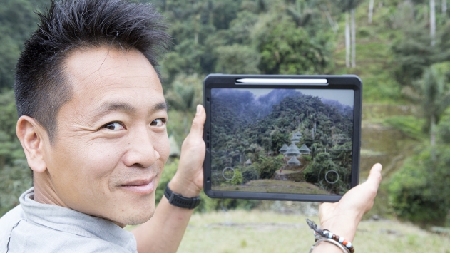
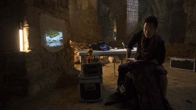
I realized that technology is not a specific thing; it’s your approach—how you look with new eyes. To me that is a superpower. For example, with LiDAR–a technology we’ve been using a lot which is basically a laser range finder–you can shoot out millions of laser pulses per second and a small percentage of them make it to the ground, some of them get caught up in the trees, but you can delete all the parts that get caught up in the noise above. You’re left with—for the first time ever—these images of the forest floor, or the jungle floor, or the side of the mountain, that you would not be able to get in any other way, other than cutting it all down. And that is, to me, the closest thing I can think of to a superpower.
S&F: Are you using technology in ways that the technology is intended to be used, or are using it in ways that perhaps engineers haven’t thought of?
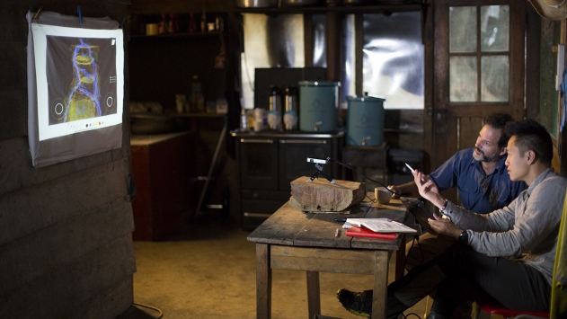
AL: Sometimes we’re actually coming up with whole new things on the fly. I have this unbelievable team by my side doing countless hours of research that brings together different aspects of what is known about any human location.. Then, in the field, I’ve got this team of engineers and archeologists who are just unbelievably dedicated, who will hike to the top of the mountain carrying huge bits of equipment like massive drones and LiDAR scanners, and will set up in the most extreme conditions.
Then, we’ll sit together and come up with programs about how to layer data. And all of a sudden you see the world as you’ve never seen it before, with a completely new perspective, with a window into our past and we’ve made real discoveries in the field.
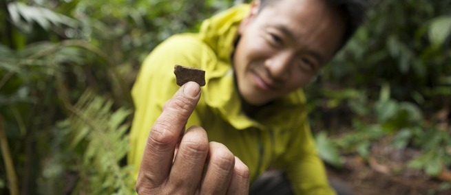
For example, we were up high in the mountains of Colombia with Santiago Geraldo and they showed me the data for the first time. [Santiago] is this archeologist who has dedicated his life to this coastal mountain range site in Colombia. And as were looking [at the data] we completely forget that we’re being filmed. We are finding things that [Santiago] had no idea about, having spent thirty years on the side of this mountain. So then the next day we wake up at dawn, and put on as much snake protection as we can, and we go out with machetes and a small squad of Colombian military soldiers. [Together we] go bushwhacking with this map into the most remote places that I’ve ever been, looking for those signatures.
Sure enough, we started find bits of evidence of cities hidden up in these mountains for hundreds of years. And then you hold a piece of pottery, a fragment of that city in your hand, that you know has been lost in time. You can actually see someone’s fingerprint embedded into the clay and you realize that you’re holding somebody’s story in your hand and that story is meaningful and is coming to light for the first time in hundreds of years. And you know that story in some way inspired the story of El Dorado, inspired legends that have influenced the way that we think of the world today, and that’s just the tip of the iceberg.
We’ve been able to do this all over the world, from Colombia to Micronesia to Peru, and it’s been one of the most incredible years of my life. I’ve had this unbelievable window into questions like, who are we? The wonders we can achieve when we really understand the power of human imagination have been breathtaking and super humbling and that’s why this year’s been the most transformative year of my life.
S&F: How has this work informed the way that you think about climate change?
AL: At UC San Diego we started a program called “Engineers for Exploration” which gets engineering students to try to solve different kinds of conservation challenges. One of the more inspiring experiences I had with LOST CITIES was seeing these different chapters of human history, when we didn’t see ourselves as so separate from nature. I think that by going on this transit around the planet and seeing all these different lost cities, what we’re seeing in these cities is lost experiments in the human condition.
S&F: Yeah, and I feel like those are also frameworks or different sorts of stories that might have a newfound resonance in our current era, with climate change where we have to rethink our relationship to nature.
AL: It has been very inspiring. While we do face this great challenge—I’ve got two little kids, so I think about it every single day, that their future is in peril—I think these lost cities around the world, and the chance to explore the different versions of the human condition, opens that window to the different versions of us that’s so important to understand if we are to build a better future.
I can’t underscore enough how much of a humbling experience this series has been, not only the subjects, contributors, and archeologists we’ve worked with, but also the team that put this thing together. It is definitely bigger than the sum of its parts and I’m just a small part of that team.
S&F: Good luck getting back to normal life after this!
AL: I’m back to another shoot actually, an island in the Pacific.
LOST CITIES premiers on National Geographic on Monday, November 4 at 8:30pm EST. LiDAR, which Lin and his team used in mapping, is not only used by explorers. A few weeks ago, Science & Film spoke with filmmaker Alex Suber about his new Virtual Reality work LUX SINE, which used LiDAR in the subterranean tunnels of the Black Hills of South Dakota. That interview is available here.
All images courtesy of National Geographic.
TOPICS
SHARE
![]()
![]()
![]()